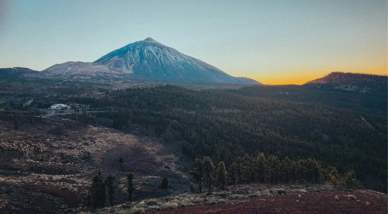
- 4Paved roads into the park
- ~2,361 mHighest point of the TF-21
- 0Petrol stations inside the park
- €150–600Fine for parking outside a marked bay
- 900 210 131Cabildo road line, 24 hours
Four Different Drives That Meet in the Caldera
This page assumes you've decided to drive and want to know which road to take.
The TF-38 from Chío is the easiest: long sweeping bends, a smooth surface and light traffic. The TF-21 via Vilaflor is the most scenic and the longest climb. The TF-21 from La Orotava is the shortest and the twistiest, through cloud forest. The TF-24 along the Dorsal ridge is the slowest, and has the best roadside viewpoints.
All four meet in the caldera, so the best answer is usually to go up one and come down another. If you're still deciding whether to drive at all, start with Teide by car or guided tour.
Check before you go. The park's central road was reclassified in 2026, and access rules are changing. Everything dated on this page was checked on 16 September 2026.
Check Availability & Prices
If the drive is what appeals, this tour puts you behind the wheel of your own Jeep Wrangler in a guided convoy from Costa Adeje, on volcanic tracks the coaches don't use, to a sunset stop above the sea of clouds. You bring your licence; they bring the Jeep and the route.
The Four Roads at a Glance
Where each starts, how long it is, and who it suits.
| Road | From | Distance | Character | Best for |
|---|---|---|---|---|
| TF-38 | Chío, Guía de Isora, Santiago del Teide | 8.3 km park section; ~25 km full climb | Steady gradient, kilometre-long bends, smooth tarmac, quiet | Nervous drivers, car-sick passengers, larger vehicles |
| TF-21 south | Los Cristianos, Costa Adeje, Arona via Vilaflor | Granadilla to Boca Tauce is km 57.5 | Wide and twisty below Vilaflor, then 6–7% through pine forest | Scenery, variety, the classic climb |
| TF-21 north | Puerto de la Cruz, La Orotava | 31 km La Orotava to El Portillo | Switchbacks, laurel cloud forest, often misty | Speed, greenery, the sea of clouds |
| TF-24 | La Laguna, Santa Cruz via La Esperanza | 30 km La Laguna to El Portillo | Long undulating ridge through pine forest | Viewpoints, the best sequence on the island |
The full TF-21 crossing, from Granadilla to La Orotava, runs about 79.3 km and tops out at around 2,361 m, which makes it one of the highest roads in Spain.
The TF-38 from Chío: the Easy One
It joins the TF-21 at Boca Tauce, so taking it costs you nothing.
The park section is officially only 8.3 km, from Chío and Guía de Isora up to Boca Tauce, though the full climb from the coast is around 25 km at an average of 5.5%. What makes it easy isn't the gradient but the shape of the road: long straight sections and sweeping curves a kilometre long, not tight hairpins, on smooth tarmac, with noticeably less traffic than the Vilaflor road. Cyclists describe the climb as almost uneventful because there's nothing to zigzag around.
The lava fields of 1798, the last eruption inside the park, dominate this whole approach, and it's the most geologically dramatic of the four.
Stops along the way
Mirador de Chío
Lower down, looking over the Santiago del Teide valley to the sea. Good at sunset, with Teide behind you. The Sunset and Stargazing at Teide National Park trip watches the sunset from a viewpoint at about 1,400 m on this side of the park (4.7 from 3,712 reviews, from $41), and its standard option has you drive your own car behind the guides.
Mirador de Sámara
Named after the volcanic cone, with a striking contrast of pines and lava, and quiet walking.
Mirador de las Narices del Teide (Chahorra)
At about km 3.2, overlooking the vents of the 1798 eruption, "Teide's nostrils", on the flank of Pico Viejo. The trailhead for route 9.
Whichever road you take, there's more to the drive than the driving: sunset and stargazing evenings in the Las Cañadas caldera, guided visits to the Teide Observatory at Izaña on the TF-24, e-bike rides around Vilaflor, quad and buggy routes through the pine forest, and small-group days to Masca and Los Gigantes that leave the Masca road to someone else.
The TF-21 via Vilaflor: the Classic Climb
The longest ascent from sea level, and less frightening than its reputation.
From the resorts you climb via Arona on the TF-51, itself a road of many hairpins and over 1,000 m of climbing, before joining the TF-21 for La Escalona and Vilaflor. Arona to Vilaflor is around 47 km of driving.
Below Vilaflor the road is broad, well surfaced and twisty without being steep, and each hairpin opens a view over the dry southern tip of the island. Above Vilaflor it enters the Corona Forestal pine forest and steepens to an average of 6–7%, climbing steadily to an unremarkable crest before the trees give way to lava and the road drops to Boca Tauce.
Drivers consistently describe it as twisty but not steep, in good condition, with a solid centre line and enough width.
Vilaflor and its trees
Vilaflor de Chasna, at about 1,400 m, is the highest village in Tenerife and the only municipality in the south with no coastline. Stop for the church of San Pedro Apóstol, the local almendrados (almond biscuits) and a grilled-meat lunch.
A short signed detour reaches two remarkable trees. The Pino Gordo stands 45.12 m tall with a circumference of 9.36 m at chest height, is roughly 700 to 800 years old, and is described as the most voluminous pine in Europe. Nearby, the Pino de las Dos Pernadas reaches 56.03 m, the tallest native tree in Spain.
The Paisaje Lunar, the pale eroded pinnacles of volcanic ash, is often listed as a roadside stop. It isn't one. Reaching it means walking the PR-TF 72, a loop of around 13.4 km from the village, so plan for it or skip it. A gentler way to see it is the Premium E-Bike Ride at Vilaflor – Lunar Landscape, with hotel pickup; it has only 9 reviews so far (all five stars), so read them before booking.
Higher up, inside the park
Boca Tauce
The TF-21/TF-38 junction, looking over the 1798 Lavas Negras flow and the Ucanca plain. No facilities.
Llano de Ucanca
Around km 49–51, the park's largest plain, with the 144 m basalt spire of La Catedral. After snow it holds a shallow lake that reflects the peaks, and in spring the red tajinaste flowers.
Zapatilla de la Reina
A rock formation eroded into the shape of a shoe.
Los Azulejos
Greenish rocks, altered by volcanic fluids, near the Roques de García viewpoint.
Roques de García
Around km 46.5, opposite the Parador: the most visited viewpoint in the park.
The TF-21 from La Orotava: the Short, Twisty One
Officially 31 km from La Orotava to El Portillo, and the road most likely to make passengers queasy.
You leave La Orotava through switchbacks lined with restaurant terraces, then enter the damp pine and laurel cloud forest around Aguamansa, at about 1,000 m. Fed by the trade winds, it's the greenest, mistiest stretch of road on the island. Above the forest you climb to El Portillo, where the road meets the TF-24.
Fog is common. So is breaking out of the cloud into blue sky partway up, which is half the appeal.
Stops along the way
La Orotava valley viewpoints
On the switchbacks above the town.
Aguamansa
Restaurants, and a trout farm at about km 14.3.
La Caldera recreation area
A turn-off at about km 16 to a wooded crater with a car park, bar-restaurant, barbecues and trailheads.
El Portillo
At about km 32.5, with the visitor centre and botanical garden.
The TF-24 Dorsal: the Viewpoint Road
Thirty kilometres from La Laguna to El Portillo, about 55 km from La Laguna itself and around 64 km from Santa Cruz.
Starting at the Padre Anchieta junction in La Laguna, the road climbs steadily along the Dorsal ridge through pine forest, passing a long run of viewpoints before skirting the Izaña observatory and joining the TF-21 at El Portillo. It rises and dips instead of climbing relentlessly.
Stops along the way, going up
Mirador de Ortuño
At around km 19, named after the forester Francisco Ortuño Medina. Quieter, with views of the north coast and the sea of clouds.
Mirador de Chipeque
A signed turn-off at around km 26, on Montaña de Chipeque at about 1,830 m. This is the famous one: the view of Teide over the Orotava valley that appeared on the old 1,000-peseta note. The Mirador de Chimague, on the same spur, has no view of Teide.
Mirador de La Tarta
At km 31.8, a road cut through layers of volcanic rock: white pumice, black basalt and rusty ochre, with a viewpoint on each side of the road. The most photogenic stop on any of the four roads.
Igueque and Montaña Limón
At km 32.8 and km 35.4, both looking over the Orotava valley.
Corral del Niño
Near Izaña, with views into both the Orotava and Güímar valleys. Excellent for stargazing.
Izaña
The astrophysical observatory complex on the ridge. You can only see it from outside unless you book the Mount Teide Observatory Guided Tour, a daytime visit that needs your own transport to the gate (4.6 from 915 reviews, from $24).
A common mistake, corrected. Ortuño and Chipeque are both on the TF-24: Ortuño at about km 19 and Chipeque at about km 26, according to the island's tourist board. A surprising amount of published content puts one of them on the northern TF-21. If you're driving up from La Orotava expecting Chipeque, you're on the wrong road.
Two Other Roads, and One to Avoid
TF-51
Connects Arona with Vilaflor, and is the usual link from the southern resorts onto the TF-21.
TF-523
From Arafo up to La Cumbre on the eastern flank: a quiet, spectacular alternative, with more than 20 km of continuous bends through pine forest before it joins the TF-24 near the ridge. Little coach traffic. For confident drivers who want the drive to be the point.
TF-436 to Masca: don't
This isn't a Teide route and shouldn't be treated as one. It's a single, very narrow mountain road with tight bends and very few passing places, and the only way to Masca. On 15 March 2026 a broken-down motorhome blocked it for nearly 24 hours between km 17 and 21 while it waited for a tow truck, as the Cabildo's road service confirmed. Locals report 120 to 130 hire cars a day coming down it, and the Cabildo now restricts access when there's a fire-risk alert.
If Masca is your destination, fine. If Teide is, ignore this road. Or leave it to a driver who does it daily: the Masca, Mount Teide and Los Gigantes Cliffs Tour covers both in a small group (5.0 from 464 reviews).
Where's the Last Fuel?
There's no working petrol station inside the national park. The old one near the cable car closed long ago.
| Route | Last fuel |
|---|---|
| TF-21 south | DISA in Vilaflor, on the TF-21 at km 68.8 |
| TF-38 west | CEPSA in Chío; DISA and Shell in Guía de Isora |
| TF-21 north | Repsol at Aguamansa / La Orotava; CEPSA "La Cañada" |
| TF-24 | PCAN on the lower TF-24; Combustibles Ruta del Teide in La Esperanza |
Mind the Vilaflor station's hours. DISA lists it as open from 07:00 to 20:00 Monday to Saturday and from 08:00 to 19:00 on Sunday, and it's the only option on that stretch. Once you're past Boca Tauce, El Portillo or the cable car, there's nothing.
What Happens in Winter?
The roads close before the weather arrives, not after.
The TF-21 and TF-24 close first and reopen last. The TF-38 from Chío tends to reopen first or stay open longest; in one January 2018 snowfall it was the only road open by midday. If snow is forecast and you're determined to go, the western approach is your best chance.
During its snow operations the Cabildo sets a 50 km/h limit on park roads, may run one-way schemes, and can close the top section between Portillo Alto and the cable car.
Snow chains are neither required nor provided. The response is closure plus snowploughs. The Cabildo announced three new machines in February 2025, at a cost of over €600,000, and the new ploughs were out for the 26 February 2026 closure after 3 cm of snow.
Closures are announced by the Cabildo and repeated on TenerifeON and in the Canarian press. The Cabildo's 24-hour road line is 900 210 131. Expect heavy local traffic when the roads reopen: snow draws half the island up the mountain.
The Central Road Is Now Run by the Park
The Cabildo de Tenerife took over full management of the park under Decreto 214/2025 of 23 December 2025. Staff and assets were formally handed over on 23 April 2026, and the new visitor model was announced in May 2026.
- The TF-21 between El Portillo and Boca TauceNo longer an island road: it's now park infrastructure. The park can impose its own traffic controls and penalties, and tow badly parked vehicles.
- Stopping and parkingOnly in authorised bays. Fines run from €150 to €600, and SEPRONA logged over a hundred offences in the first quarter of 2024 alone, most of them badly parked cars.
- Coming laterAccess control at the La Esperanza, La Orotava and Vilaflor–Chío entrances, a cap of 500 pre-booked parking spaces, and an ecotasa for non-residents, with hire cars reportedly required to reserve parking and pay.
- From 2027A shuttle network, which the Cabildo says will cost visitors about €7 and be free for Tenerife residents.
Sharing the Road
Cyclists
Teide is one of Europe's great climbs and a winter altitude base for professional teams. Expect riders on all four roads, most at weekends, with the TF-21 from Vilaflor the benchmark ascent. Give them plenty of room on blind bends, don't cut the centre line, and remember that cyclists coming down move fast.
Coaches
Busiest on the southern TF-21 and the TF-38, plus the northern TF-21. They peak at the main stops (Roques de García, the cable car, El Portillo) between late morning and early afternoon. Start early and you're ahead of them.
Motion sickness
The TF-38 is the gentlest and the northern TF-21 the worst. Put anyone prone to it in the front, keep them looking at the horizon, and build in viewpoint stops.
At night
The roads are unlit on purpose: this is a Starlight area. Watch for rabbits and the occasional Barbary sheep in the pine forest, cyclists without lights, tourists stopping suddenly for photos, and ice above 2,000 m in winter. Fog is common on the northern TF-21 and the TF-24. Slow down.
Building a Loop
The best reason to know these roads is that you can combine them.
From the southern resorts
Up the TF-21 via Vilaflor, across the caldera to Boca Tauce, down the TF-38 to Chío and back along the west coast, or the reverse. Roughly four to six hours of driving plus stops, and comfortably a day.
From Puerto de la Cruz and the north
Up the TF-21 via La Orotava and Aguamansa to El Portillo, then down the TF-24 past Izaña, Chipeque and Ortuño to La Laguna. It pairs the cloud forest with the ridge viewpoints and spares you the twisty northern climb twice.
The grand crossing
In from the south via Vilaflor and out to the north via La Orotava, turning the day into a coast-to-coast crossing of the island. Very doable with an early start, though adding the cable car makes it a long day.
The full circuit
Up via Vilaflor, out via Chío and back down the coast. It works for confident drivers but leaves little time for walking.
For how a loop fits around the cable car, a walk and lunch, see one day at Teide, hour by hour.
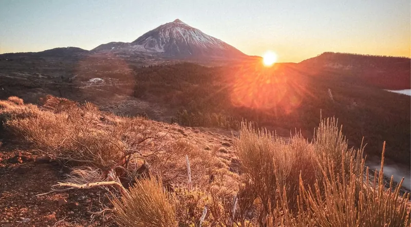 End the drive with the stars
Sunset and Stargazing at Teide National Park
Includes: Starlight-certified guides, a telescope session, a glass of cava and an astrophotography portrait. On the standard option you drive your own hire car to the meeting point and follow the guides; hotel pickup comes only with the VIP option. Remember the drive down is in the dark.
Check availability
End the drive with the stars
Sunset and Stargazing at Teide National Park
Includes: Starlight-certified guides, a telescope session, a glass of cava and an astrophotography portrait. On the standard option you drive your own hire car to the meeting point and follow the guides; hotel pickup comes only with the VIP option. Remember the drive down is in the dark.
Check availability
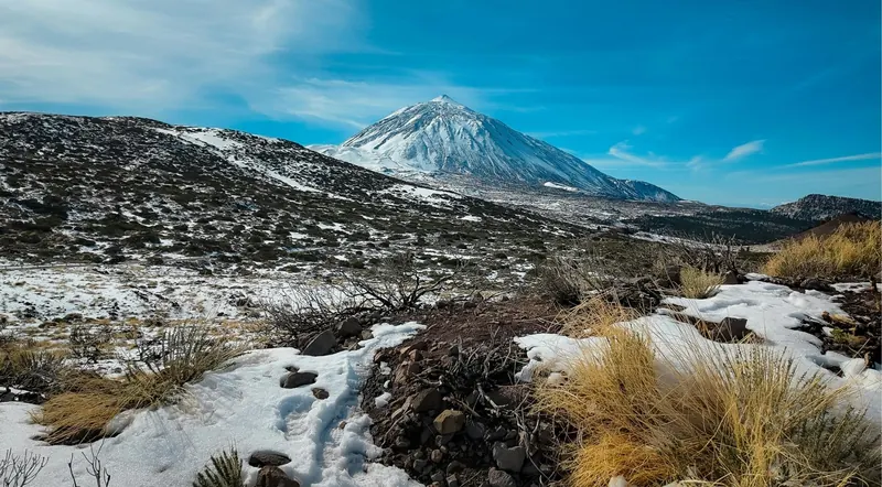 A stop on the TF-24 loop
Mount Teide Observatory Guided Tour
Includes: entry to the observatory at Izaña, a guided visit and use of two solar telescopes. Transport isn't included, which suits a driver: arrive at the gate 30 minutes early. Not for children under 8 or people with reduced mobility.
Check availability
A stop on the TF-24 loop
Mount Teide Observatory Guided Tour
Includes: entry to the observatory at Izaña, a guided visit and use of two solar telescopes. Transport isn't included, which suits a driver: arrive at the gate 30 minutes early. Not for children under 8 or people with reduced mobility.
Check availability
Rules and Hazards for Drivers
- Park only in marked bays. The fine is €150 to €600, and cars can now be towed.
- Drones are banned without park authorisation, and offenders are reported to AESA, Spain's aviation authority.
- Camping and fires are prohibited, and that includes sleeping in vehicles.
- Altitude affects the car as well as you. Engines without a turbo lose power above 2,000 m. Expect thinner air, stronger sun and cooler temperatures than on the coast.
- Hire cars are allowed on all four paved roads. Rental agreements typically rule out unpaved forest tracks, and many of those tracks are closed to private traffic anyway.
- If you break down, call 112 and get off the carriageway into an authorised bay if you can. On the narrow forest sections a stopped car blocks the road. There's no fuel and no garage inside the park.
Common Claims That Are Wrong
"Chipeque is on the road up from La Orotava"
It isn't. Both Chipeque and Ortuño are on the TF-24.
"The TF-21 is dangerous"
Overstated. It's twisty but wide, well surfaced and has barriers where it's exposed. The difficult road on the island is the TF-436 to Masca, which has nothing to do with Teide.
"There's fuel up at Teide"
There isn't. The old station is closed.
"You can drive to the summit"
The paved road ends at around 2,350 m, at the cable car base. The peak needs the cable car plus a permit for the final cone.
Anything written before 2024 about parking and access
Likely out of date, given the enforcement crackdown and the 2026 reclassification.
Driving to Teide: Your Questions
Quick answers on roads, views, hire cars and snow.
Which road to Teide is easiest to drive?
The TF-38 from Chío, comfortably. It has a steady gradient, long bends, a good surface and less traffic.
Which road to Teide has the best views?
The TF-24 for roadside viewpoints, the TF-21 via Vilaflor for the variety of the climb, and the TF-38 for the lava fields. They're very different drives, which is why a loop pays off.
Can I drive up to Teide and back in a morning?
From La Orotava or Puerto de la Cruz, yes. From the southern resorts, the driving alone takes about two and a half hours there and back.
Is a hire car allowed on the roads to Teide?
Yes, on all four paved approaches. Hire contracts typically rule out unpaved tracks, and many forest tracks are closed to private traffic anyway.
What happens on the Teide roads if it snows?
Check before you leave, on 900 210 131 or with the Cabildo and TenerifeON. The TF-38 is your best chance of an open road. Don't buy chains; the roads simply close.
Where can I stop for photographs on the way up to Teide?
Only in marked bays and laybys. Stopping on the carriageway is an offence, and on the central TF-21 your car can now be towed.
More on Planning a Teide Day
Planning the day around the drive, where to park, and what it all costs.
- One day at TeideAn hour-by-hour plan, the cable car timings and one-day car hire.
- Parking at TeideEvery car park, when each fills, and the €150–600 fine for getting it wrong.
- Cheaper to rent a car or take a tour?The worked comparison, with 2026 prices for hire, fuel, the cable car and the ecotasa.
- Drive or guided tour?Which option suits your party, from nervous drivers to stargazers.
- Is the cable car worth it?What the ticket gets you at 3,555 m, and what to do when wind closes it.
- Teide without a carThe once-daily buses, tours with hotel pickup, taxis, and a night in the park.